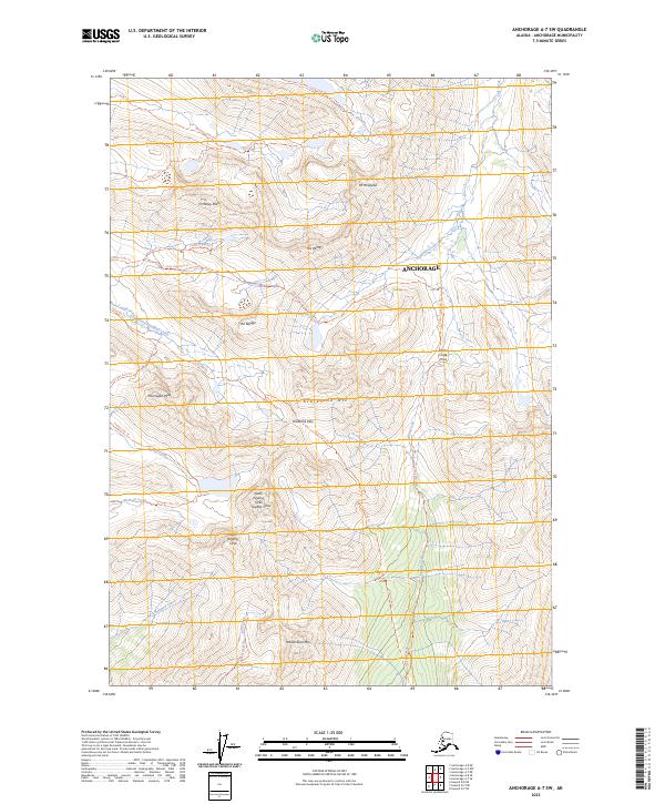
2023 Map of Anchorage A-7 SW
USGS Topo · Published 2023About this map
O'Malley Peak and Mt Williwaw dominate this high-altitude landscape within the eastern reaches of Anchorage. The map reveals an intricate network of backcountry routes, where the Powerline Trl and Powerline Pass provide a critical east-west passage through the Chugach front range. These trails follow natural corridors between steep summits like The Wedge and The Ramp, illustrating how modern recreation and utility infrastructure utilize traditional mountain gaps.
Find a feature on this map
35 named features on this map. Tap any name to fly to it.
Don’t see what you’re looking for? This feature index may not catch every label — zoom into the map to look around manually.
Map Details
Editions of this 2023 Anchorage A-7 SW Map
This is the sole edition of this map. No revisions or reprints were ever made.
Other maps of this area

1951 · Seward
USGS Topo · 1:250,000

1951 · Anchorage
USGS Topo · 1:250,000

1951 · Seward D-8
USGS Topo · 1:63,360

1951 · Seward D-7
USGS Topo · 1:63,360

1952 · Seward D-8
USGS Topo · 1:63,360

1952 · Seward D-7
USGS Topo · 1:63,360

1952 · Anchorage A-8
USGS Topo · 1:63,360

1953 · Anchorage A-8
USGS Topo · 1:63,360

1953 · Seward
USGS Topo · 1:250,000

1959 · Seward
USGS Topo · 1:250,000