
1952 Map of Seward D-7
USGS Topo · Published 1954About this map
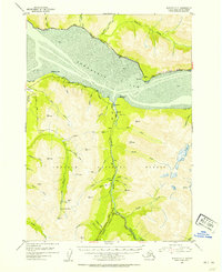
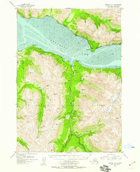
The Alaska Railroad skirts the northern mud flats of Turnagain Arm in this 1952 topographic survey, connecting the small coastal settlements of Indian and Bird. The landscape is dominated by the steep peaks of the Chugach National Forest, where a network of mining operations and remote camps are accessed via the Hope Highway and Palmer Creek Road. The proximity of the shoreline to the high mountain ridges creates a dramatic relief, with an average tidal range of 30 feet recorded at the coast.
Find a feature on this map
58 named features on this map. Tap any name to fly to it.
Don’t see what you’re looking for? This feature index may not catch every label — zoom into the map to look around manually.
Map Details
Editions of this 1952 Seward D-7 Map
3 editions found
Other maps of this area

1951 · Seward
USGS Topo · 1:250,000

1951 · Anchorage
USGS Topo · 1:250,000

1951 · Seward C-6
USGS Topo · 1:63,360

1951 · Seward C-8
USGS Topo · 1:63,360

1951 · Seward D-8
USGS Topo · 1:63,360

1951 · Seward D-7
USGS Topo · 1:63,360

1951 · Seward C-7
USGS Topo · 1:63,360

1951 · Seward D-6
USGS Topo · 1:63,360

1952 · Seward C-6
USGS Topo · 1:63,360

1952 · Seward D-8
USGS Topo · 1:63,360