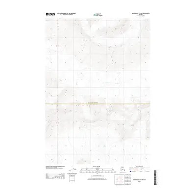
2013 Map of Anchorage B-3 NW
USGS Topo · Published 2013About this map
The Matanuska-Susitna and Valdez-Cordova boundary line cuts through this high-altitude landscape, where the movement of ice dominates the geography. This 2013 survey provides a detailed topographic view of two major ice fields: the Marcus Baker Glacier in the north and the Knik Glacier to the south. The intricate contour lines reveal the massive elevation changes and the flow patterns of these frozen giants. Unlike many topographic sheets that document human settlement and infrastructure, this map is defined by its nearly total absence of roads or structures, focusing instead on the raw physical geography of the Chugach Mountains. It serves as a precise record of glacial extent and the natural divide between these two administrative regions during the early 21st century.
Find a feature on this map
6 named features on this map. Tap any name to fly to it.
Don’t see what you’re looking for? This feature index may not catch every label — zoom into the map to look around manually.
Map Details
Editions of this 2013 Anchorage B-3 NW Map
This is the sole edition of this map. No revisions or reprints were ever made.
Other maps of this area

1951 · Anchorage
USGS Topo · 1:250,000

1960 · Anchorage B-4
USGS Topo · 1:63,360

1960 · Anchorage C-3
USGS Topo · 1:63,360

1960 · Anchorage B-3
USGS Topo · 1:63,360

1960 · Anchorage C-4
USGS Topo · 1:63,360

1962 · Anchorage
USGS Topo · 1:250,000

1979 · Anchorage
USGS Topo · 1:250,000

1993 · Anchorage C-3
USGS Topo · 1:63,360

1994 · Anchorage B-4
USGS Topo · 1:63,360
1994 · Anchorage C-4
USGS Topo · 1:63,360