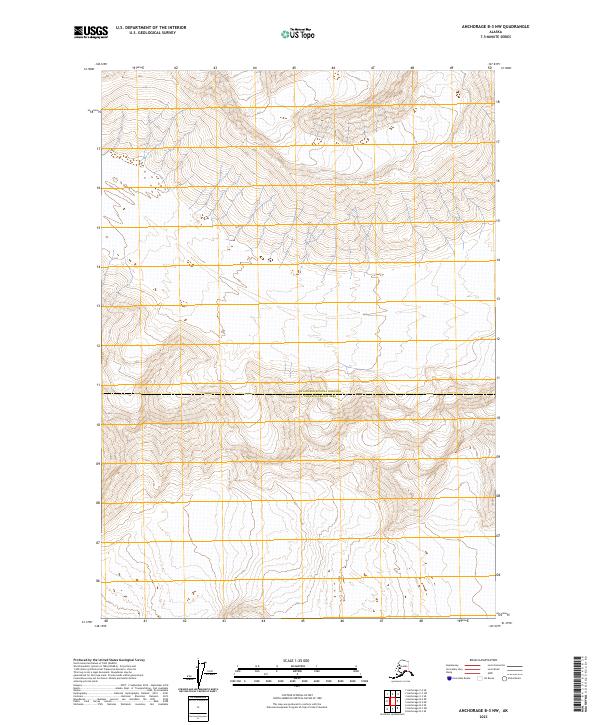
2023 Map of Anchorage B-3 NW
USGS Topo · Published 2023About this map
The boundary between the Matanuska-Susitna Borough and the Chugach Census Area serves as the primary human landmark across this high-elevation terrain. This 2023 edition presents a landscape defined by extreme topography and the Public Land Survey System grids of t16n r8e, t16n r7e, t15n r7e, and t15n r8e. The absence of named settlements, roads, or localized features underscores the isolation of this wilderness area within the Anchorage B-3 NW quadrangle. For those studying administrative divisions or modern topography, the map provides precise data on the watershed and jurisdictional lines that separate these two major Alaskan regions.
Find a feature on this map
5 named features on this map. Tap any name to fly to it.
Don’t see what you’re looking for? This feature index may not catch every label — zoom into the map to look around manually.
Map Details
Editions of this 2023 Anchorage B-3 NW Map
This is the sole edition of this map. No revisions or reprints were ever made.
Other maps of this area

1951 · Anchorage
USGS Topo · 1:250,000

1960 · Anchorage B-4
USGS Topo · 1:63,360

1960 · Anchorage C-3
USGS Topo · 1:63,360

1960 · Anchorage B-3
USGS Topo · 1:63,360

1960 · Anchorage C-4
USGS Topo · 1:63,360

1962 · Anchorage
USGS Topo · 1:250,000

1979 · Anchorage
USGS Topo · 1:250,000

1993 · Anchorage C-3
USGS Topo · 1:63,360

1994 · Anchorage B-4
USGS Topo · 1:63,360
1994 · Anchorage C-4
USGS Topo · 1:63,360