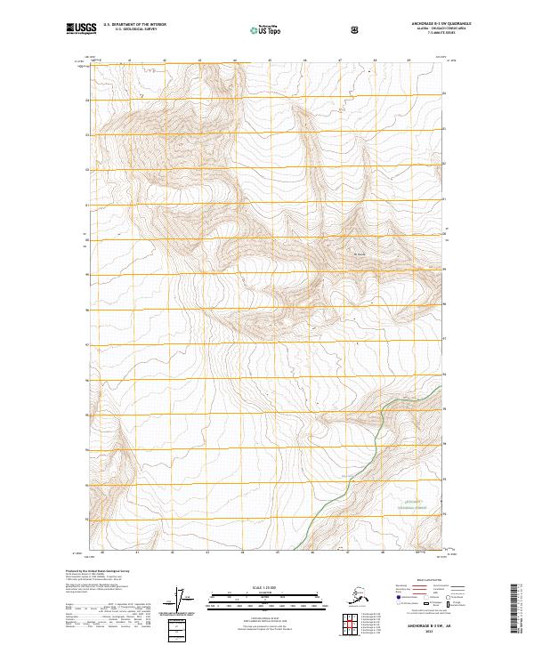
2023 Map of Anchorage B-3 SW
USGS Topo · Published 2023About this map
Mt Goode dominates the high-elevation landscape of the northern Chugach Range in this 2023 survey. This map highlights a region of profound verticality, where the massive ice flow of Barry Glacier carves through the mountain terrain in the southeastern quadrant. The area is largely contained within the protected expanse of the Chugach National Forest, reflecting a wilderness defined by glacial activity and high peaks rather than human infrastructure or road networks. Surveying from the early 21st century reveals the reach of these ice fields across various townships including t15n r7e, providing a precise record of the glaciated terrain and topographic relief at this point in the modern era.
Find a feature on this map
9 named features on this map. Tap any name to fly to it.
Don’t see what you’re looking for? This feature index may not catch every label — zoom into the map to look around manually.
Map Details
Editions of this 2023 Anchorage B-3 SW Map
This is the sole edition of this map. No revisions or reprints were ever made.
Other maps of this area

1951 · Anchorage
USGS Topo · 1:250,000

1960 · Anchorage A-4
USGS Topo · 1:63,360

1960 · Anchorage A-3
USGS Topo · 1:63,360

1960 · Anchorage B-4
USGS Topo · 1:63,360

1960 · Anchorage B-3
USGS Topo · 1:63,360

1962 · Anchorage
USGS Topo · 1:250,000

1979 · Anchorage
USGS Topo · 1:250,000

1994 · Anchorage B-4
USGS Topo · 1:63,360
2013 · Anchorage B-3 SE
USGS Topo · 1:25,000
2013 · Anchorage A-3 NW
USGS Topo · 1:25,000