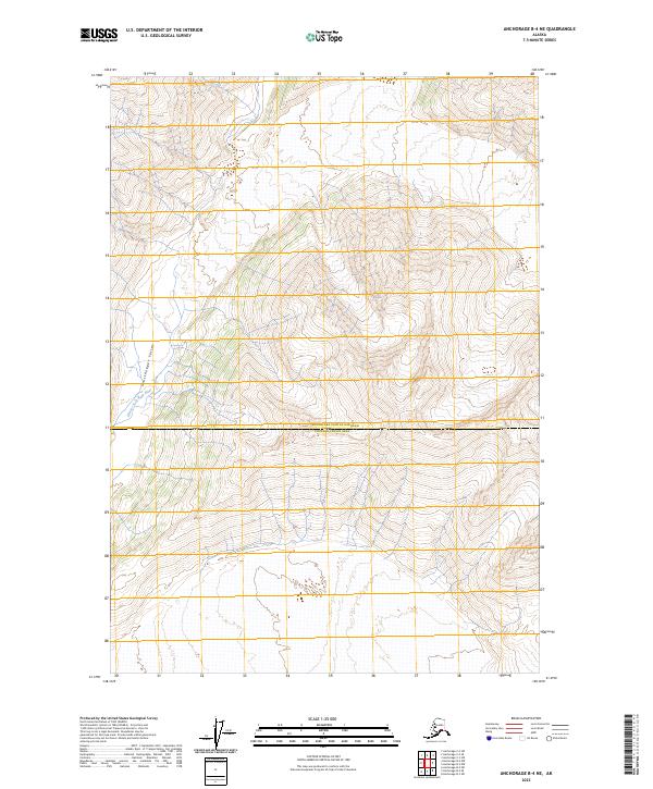
2023 Map of Anchorage B-4 NE
USGS Topo · Published 2023About this map
The Glacier Fork Knik River carves a deep path through this corner of the Southcentral Alaskan wilderness, where the southern reaches of the Grasshopper Valley meet rising alpine terrain. This 2023 map captures a high-elevation landscape defined by the intersection of the Matanuska-Susitna Borough and the Chugach Census Area. The absence of developed roads or permanent settlements underscores the primitive state of this glacial drainage system, which remains dominated by natural watercourses and the high-relief contours of the surrounding mountains. Surveyed under the modern US Topo standard, the sheet provides a precise accounting of contemporary hydrology and land boundaries in a region where the braided river channels are subject to seasonal shifts from glacial melt.
Find a feature on this map
8 named features on this map. Tap any name to fly to it.
Don’t see what you’re looking for? This feature index may not catch every label — zoom into the map to look around manually.
Map Details
Editions of this 2023 Anchorage B-4 NE Map
This is the sole edition of this map. No revisions or reprints were ever made.
Other maps of this area

1951 · Anchorage
USGS Topo · 1:250,000

1960 · Anchorage B-4
USGS Topo · 1:63,360

1960 · Anchorage C-3
USGS Topo · 1:63,360

1960 · Anchorage B-3
USGS Topo · 1:63,360

1960 · Anchorage C-4
USGS Topo · 1:63,360

1962 · Anchorage
USGS Topo · 1:250,000

1979 · Anchorage
USGS Topo · 1:250,000

1993 · Anchorage C-3
USGS Topo · 1:63,360

1994 · Anchorage B-4
USGS Topo · 1:63,360
1994 · Anchorage C-4
USGS Topo · 1:63,360