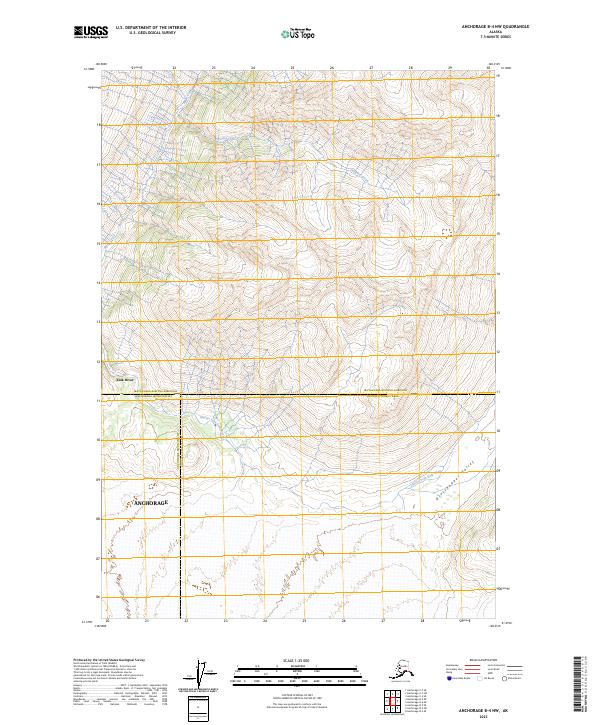
2023 Map of Anchorage B-4 NW
USGS Topo · Published 2023About this map
The Knik River valley dominates this 2023 survey of the remote transition between the Matanuska-Susitna Borough and the Anchorage municipal lands. This high-altitude terrain is defined by the massive drainage systems of the Glacier Fork Knik River and its major tributaries, including Metal Creek and Paradise Creek. The map documents the vast and uninhabited Grasshopper Valley, providing a contemporary record of these shifting glacial waterways and the complex administrative boundaries that intersect the Alaskan wilderness. The presence of the Chugach Census Area boundary through these steep mountain ranges highlights the unique intersection of modern political borders and untamed landscapes.
Find a feature on this map
13 named features on this map. Tap any name to fly to it.
Don’t see what you’re looking for? This feature index may not catch every label — zoom into the map to look around manually.
Map Details
Editions of this 2023 Anchorage B-4 NW Map
This is the sole edition of this map. No revisions or reprints were ever made.
Other maps of this area

1951 · Anchorage
USGS Topo · 1:250,000

1951 · Anchorage C-5
USGS Topo · 1:63,360

1952 · Anchorage C-5
USGS Topo · 1:63,360

1960 · Anchorage C-5
USGS Topo · 1:63,360

1960 · Anchorage B-5
USGS Topo · 1:63,360

1960 · Anchorage B-4
USGS Topo · 1:63,360

1960 · Anchorage C-4
USGS Topo · 1:63,360

1962 · Anchorage
USGS Topo · 1:250,000

1979 · Anchorage
USGS Topo · 1:250,000

1994 · Anchorage B-4
USGS Topo · 1:63,360