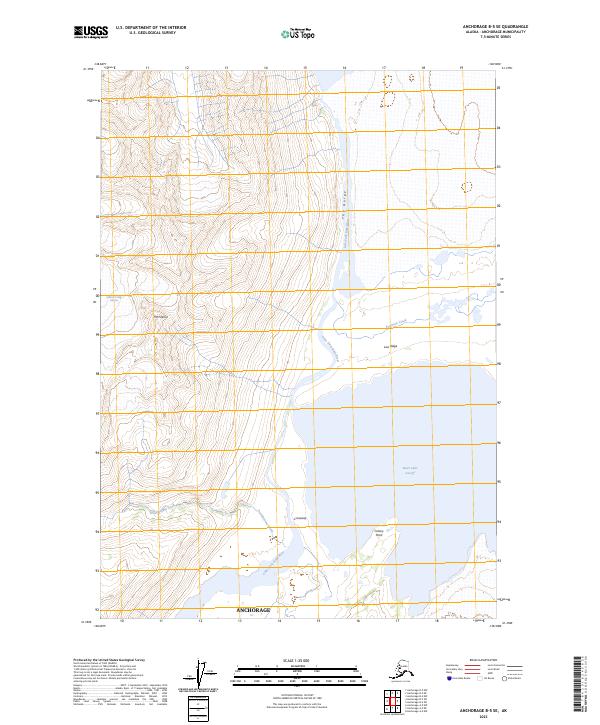
2023 Map of Anchorage B-5 SE
USGS Topo · Published 2023About this map
The glacial waters of Inner Lake George and the Lake Fork Knik River dominate this wilderness area northeast of Anchorage. High peaks like Mt Palmer overlook a landscape shaped by ice and water, where the Hunter Creek Glacier feeds into the complex drainage system of the Chugach Mountains. The topographical data highlights the dramatic elevation changes at The Gorge and along the Low Ridge, showing the natural barriers that define this region. Further south, the map tracks the path of Troublesome Creek as it moves toward the Lake Fork Knik River, passing landmarks such as Crossway and Colony Point. This survey provides a precise modern record of a landscape where seasonal water levels and glacial movement dictate the shifting shoreline and river paths.
Find a feature on this map
17 named features on this map. Tap any name to fly to it.
Don’t see what you’re looking for? This feature index may not catch every label — zoom into the map to look around manually.
Map Details
Editions of this 2023 Anchorage B-5 SE Map
This is the sole edition of this map. No revisions or reprints were ever made.
Other maps of this area

1951 · Anchorage
USGS Topo · 1:250,000

1960 · Anchorage A-5
USGS Topo · 1:63,360

1960 · Anchorage A-4
USGS Topo · 1:63,360

1960 · Anchorage B-5
USGS Topo · 1:63,360

1960 · Anchorage B-4
USGS Topo · 1:63,360

1962 · Anchorage
USGS Topo · 1:250,000

1979 · Anchorage
USGS Topo · 1:250,000

1994 · Anchorage B-4
USGS Topo · 1:63,360
1994 · Anchorage B-5
USGS Topo · 1:63,360
2013 · Anchorage B-4 SW
USGS Topo · 1:25,000