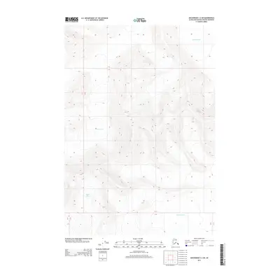
2013 Map of Anchorage C-2 SW
USGS Topo · Published 2013About this map
Matanuska Glacier and Marcus Baker Glacier dominate this high-elevation landscape within the Matanuska-Susitna region. The terrain is characterized by extreme topographic relief, with steep contour intervals tracing the massive ice fields and ridges that define this portion of the Chugach Mountains. Unlike maps of settled lowlands, this 2013 survey is almost entirely devoid of human infrastructure, focusing instead on the glaciated geography and the complex hydrological patterns of the ice. The prominence of these glaciers illustrates the vast scale of the Alaskan wilderness, where natural boundaries like the township lines for T 17 N and T 18 N are imposed upon a largely roadless and unpopulated environment.
Find a feature on this map
6 named features on this map. Tap any name to fly to it.
Don’t see what you’re looking for? This feature index may not catch every label — zoom into the map to look around manually.
Map Details
Editions of this 2013 Anchorage C-2 SW Map
This is the sole edition of this map. No revisions or reprints were ever made.
Other maps of this area

1951 · Anchorage
USGS Topo · 1:250,000

1960 · Anchorage C-2
USGS Topo · 1:63,360

1960 · Anchorage C-3
USGS Topo · 1:63,360

1960 · Anchorage B-3
USGS Topo · 1:63,360

1960 · Anchorage B-2
USGS Topo · 1:63,360

1962 · Anchorage
USGS Topo · 1:250,000

1979 · Anchorage
USGS Topo · 1:250,000
1993 · Anchorage C-2
USGS Topo · 1:63,360

1993 · Anchorage C-3
USGS Topo · 1:63,360
2013 · Anchorage C-2 NE
USGS Topo · 1:25,000