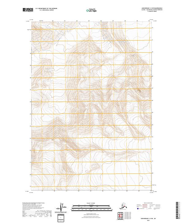
2023 Map of Anchorage C-2 SW
USGS Topo · Published 2023About this map
Elevation contours and township boundaries define this high-altitude landscape in the T17n R10e and T18n R10e regions. This survey of the Matanuska-Susitna Borough emphasizes the verticality of the terrain, where closely packed contour lines reveal a complex mountain environment. Unlike more developed lowland maps, this 2023 edition shows an area largely defined by its natural topography and the Public Land Survey System grid, including T17n R9e and T16n R10e. The absence of named human settlements or roadways highlights the isolation of this sector, making it an essential reference for understanding the physical geography of the Alaskan interior without the overlay of modern infrastructure.
Find a feature on this map
7 named features on this map. Tap any name to fly to it.
Don’t see what you’re looking for? This feature index may not catch every label — zoom into the map to look around manually.
Map Details
Editions of this 2023 Anchorage C-2 SW Map
This is the sole edition of this map. No revisions or reprints were ever made.
Other maps of this area

1951 · Anchorage
USGS Topo · 1:250,000

1960 · Anchorage C-2
USGS Topo · 1:63,360

1960 · Anchorage C-3
USGS Topo · 1:63,360

1960 · Anchorage B-3
USGS Topo · 1:63,360

1960 · Anchorage B-2
USGS Topo · 1:63,360

1962 · Anchorage
USGS Topo · 1:250,000

1979 · Anchorage
USGS Topo · 1:250,000
1993 · Anchorage C-2
USGS Topo · 1:63,360

1993 · Anchorage C-3
USGS Topo · 1:63,360
2013 · Anchorage C-2 SW
USGS Topo · 1:25,000