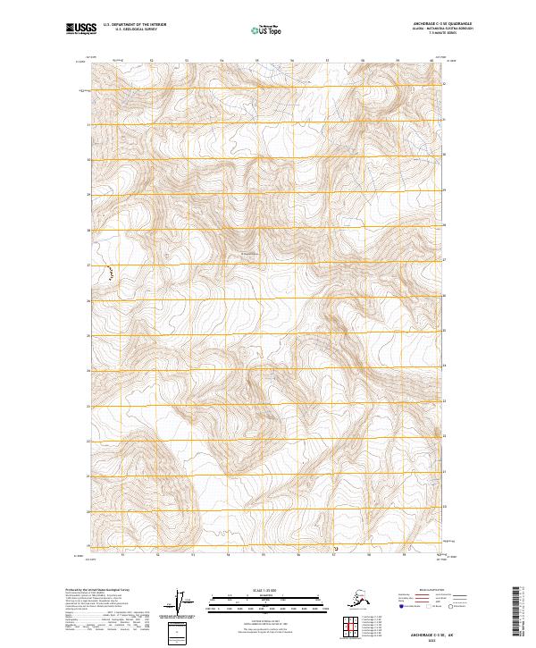
2023 Map of Anchorage C-3 SE
USGS Topo · Published 2023About this map
Mt Sergeant Robinson dominates the high-altitude landscape of this remote section of the Chugach Mountains within the Matanuska-Susitna Borough. This modern 2023 survey delineates the complex topography through several townships, including t18n r9e, t17n r9e, and t16n r9e, where steep slopes and vertical relief define the land. The absence of roads, settlements, or established infrastructure underscores the wilderness character of this area, which is primarily characterized by its elevation and natural drainage patterns. For researchers or mountaineers, this document provides the current Public Land Survey System (PLSS) grid overlay across the wilderness terrain, offering precise coordinates for navigating or studying the undeveloped peaks and ridges surrounding the central summit.
Find a feature on this map
7 named features on this map. Tap any name to fly to it.
Don’t see what you’re looking for? This feature index may not catch every label — zoom into the map to look around manually.
Map Details
Editions of this 2023 Anchorage C-3 SE Map
This is the sole edition of this map. No revisions or reprints were ever made.
Other maps of this area

1951 · Anchorage
USGS Topo · 1:250,000

1960 · Anchorage C-2
USGS Topo · 1:63,360

1960 · Anchorage C-3
USGS Topo · 1:63,360

1960 · Anchorage B-3
USGS Topo · 1:63,360

1960 · Anchorage B-2
USGS Topo · 1:63,360

1962 · Anchorage
USGS Topo · 1:250,000

1979 · Anchorage
USGS Topo · 1:250,000
1993 · Anchorage C-2
USGS Topo · 1:63,360

1993 · Anchorage C-3
USGS Topo · 1:63,360
2013 · Anchorage C-2 SW
USGS Topo · 1:25,000