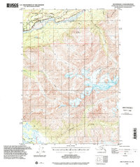
1994 Map of Anchorage C-5
USGS Topo · Published 2002About this map
Matanuska Valley serves as the focal point of this 1994 topographic study, capturing the intersection of the Matanuska River and the high-elevation terrain of the Moose Range. The landscape transitions from the river flats near Finger Lakes in the south to the massive peaks of Kings Mtn and Pinnacle Mountain in the north. The presence of the Glenn Highway and a remote Landing Strip highlights the vital, albeit sparse, transportation network required to navigate this portion of the Matanuska-Susitna Borough.
Find a feature on this map
19 named features on this map. Tap any name to fly to it.
Don’t see what you’re looking for? This feature index may not catch every label — zoom into the map to look around manually.
Map Details
Editions of this 1994 Anchorage C-5 Map
This is the sole edition of this map. No revisions or reprints were ever made.
Other maps of this area

1948 · Anchorage D-4
USGS Topo · 1:63,360

1949 · Anchorage D-5
USGS Topo · 1:63,360

1950 · Anchorage D-6
USGS Topo · 1:63,360

1951 · Anchorage
USGS Topo · 1:250,000

1951 · Anchorage C-6
USGS Topo · 1:63,360

1951 · Anchorage C-5
USGS Topo · 1:63,360

1952 · Anchorage D-6
USGS Topo · 1:63,360

1952 · Anchorage D-5
USGS Topo · 1:63,360

1952 · Anchorage D-4
USGS Topo · 1:63,360

1952 · Anchorage C-5
USGS Topo · 1:63,360