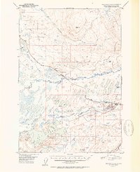
1952 Map of Anchorage C-8
USGS Topo · Published 1952About this map
The Susitna River and Little Susitna River dominate this early 1950s landscape, illustrating the critical transportation corridors that shaped the Matanuska-Susitna region. The path of The Alaska Railroad cuts through the territory, passing through small railside settlements like Houston and Pittman. This era highlights the early extraction economy of the area, clearly marking the Houston Strip Mine and a local Coal Mine near the riverbanks.
Find a feature on this map
28 named features on this map. Tap any name to fly to it.
Don’t see what you’re looking for? This feature index may not catch every label — zoom into the map to look around manually.
Map Details
Editions of this 1952 Anchorage C-8 Map
2 editions found

Other maps of this area

1949 · Tyonek
USGS Topo · 1:250,000

1949 · Anchorage D-7
USGS Topo · 1:63,360

1949 · Anchorage D-8
USGS Topo · 1:63,360

1950 · Anchorage C-8
USGS Topo · 1:63,360

1950 · Anchorage C-7
USGS Topo · 1:63,360

1951 · Anchorage
USGS Topo · 1:250,000

1951 · Tyonek
USGS Topo · 1:250,000

1951 · Anchorage C-7
USGS Topo · 1:63,360

1951 · Anchorage D-8
USGS Topo · 1:63,360

1951 · Anchorage D-7
USGS Topo · 1:63,360