
1948 Map of Anchorage D-1
USGS Topo · Published 1967About this map
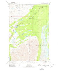
Eureka Roadhouse serves as the central landmark for this late-1940s landscape, situated along the Glenn Highway in the Matanuska-Susitna region. The presence of the Eureka Roadhouse Landing Strip and a network of Tractor Trails indicates the reliance on bush aviation and heavy machinery to navigate the Alaskan interior during this era. The topography is dominated by water and high-altitude crossings, including the glacial waters of the Nelchina River and the high elevations of Belanger Pass and Tahneta Pass.
Find a feature on this map
31 named features on this map. Tap any name to fly to it.
Don’t see what you’re looking for? This feature index may not catch every label — zoom into the map to look around manually.
Map Details
Editions of this 1948 Anchorage D-1 Map
4 editions found
Other maps of this area

1948 · Anchorage D-2
USGS Topo · 1:63,360

1949 · Talkeetna Mountains A-1
USGS Topo · 1:63,360

1949 · Gulkana A-6
USGS Topo · 1:63,360

1949 · Valdez D-8
USGS Topo · 1:63,360

1950 · Talkeetna Mountains
USGS Topo · 1:250,000

1951 · Gulkana
USGS Topo · 1:250,000

1951 · Anchorage
USGS Topo · 1:250,000

1951 · Anchorage D-1
USGS Topo · 1:63,360

1952 · Valdez D-8
USGS Topo · 1:63,360

1952 · Anchorage D-2
USGS Topo · 1:63,360