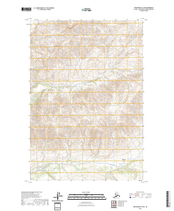
2023 Map of Anchorage D-2 NE
USGS Topo · Published 2023About this map
Horn Mountains dominate the center of this Matanuska-Susitna survey, flanked by a complex drainage system that defines the local geography. Running through the heart of the landscape, Alfred Creek and its many tributaries, including Papoose Creek and Bench Creek, illustrate the intricate watershed patterns typical of this region. The southern edge of the map transitions toward Glacier View, where the topography shifts near the shores of Water Lily Lake.
Find a feature on this map
18 named features on this map. Tap any name to fly to it.
Don’t see what you’re looking for? This feature index may not catch every label — zoom into the map to look around manually.
Map Details
Editions of this 2023 Anchorage D-2 NE Map
This is the sole edition of this map. No revisions or reprints were ever made.
Other maps of this area

1948 · Anchorage D-2
USGS Topo · 1:63,360

1948 · Anchorage D-1
USGS Topo · 1:63,360

1949 · Talkeetna Mountains A-1
USGS Topo · 1:63,360

1950 · Talkeetna Mountains
USGS Topo · 1:250,000

1951 · Anchorage
USGS Topo · 1:250,000

1951 · Anchorage D-1
USGS Topo · 1:63,360

1951 · Talkeetna Mountains A-2
USGS Topo · 1:63,360

1952 · Anchorage D-2
USGS Topo · 1:63,360
1952 · Talkeetna Mountains A-1
USGS Topo · 1:63,360
1952 · Talkeetna Mountains A-2
USGS Topo · 1:63,360