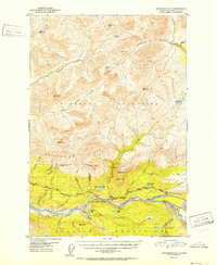
1952 Map of Anchorage D-3
USGS Topo · Published 1952About this map
The Matanuska River carves a massive valley between the southern Chugach Mountains and the northern Talkeetna Mountains in this early 1950s survey. The landscape is dominated by the retreat of the Matanuska Glacier and the industrial-era push of the Glenn Highway through the mountain passes. The presence of Anthracite Ridge suggests the geologic wealth of the region, while isolated outposts like the Watchtower Inn and a lonely Cabin near Index Lake show the sparse, road-dependent settlement pattern of the interior at this time.
Find a feature on this map
44 named features on this map. Tap any name to fly to it.
Don’t see what you’re looking for? This feature index may not catch every label — zoom into the map to look around manually.
Map Details
Editions of this 1952 Anchorage D-3 Map
2 editions found
Other maps of this area

1948 · Anchorage D-3
USGS Topo · 1:63,360

1948 · Anchorage D-2
USGS Topo · 1:63,360

1948 · Anchorage D-4
USGS Topo · 1:63,360

1950 · Talkeetna Mountains
USGS Topo · 1:250,000

1951 · Anchorage
USGS Topo · 1:250,000

1951 · Talkeetna Mountains A-2
USGS Topo · 1:63,360

1951 · Talkeetna Mountains A-3
USGS Topo · 1:63,360

1952 · Anchorage D-2
USGS Topo · 1:63,360

1952 · Anchorage D-4
USGS Topo · 1:63,360

1952 · Anchorage D-3
USGS Topo · 1:63,360