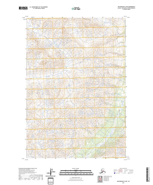
2023 Map of Anchorage D-4 NW
USGS Topo · Published 2023About this map
The Chickaloon River valley and its surrounding drainage systems define this landscape in the Matanuska-Susitna Borough. This high-resolution survey focuses on the intricate networks of Moss Creek in the northeast and Doone Creek in the southwest, mapping the rugged interior just as it appeared in the early 21st century. The map provides a detailed view of the terrain's hydrology and land divisions, including the boundaries for t22n r6e and t21n r5e. While the area is largely characterized by its natural water features and steep elevation changes, the documentation of these specific creek systems and township lines offers essential data for understanding the physical geography and administrative layout of this part of Alaska.
Find a feature on this map
7 named features on this map. Tap any name to fly to it.
Don’t see what you’re looking for? This feature index may not catch every label — zoom into the map to look around manually.
Map Details
Editions of this 2023 Anchorage D-4 NW Map
This is the sole edition of this map. No revisions or reprints were ever made.
Other maps of this area

1948 · Anchorage D-4
USGS Topo · 1:63,360

1949 · Anchorage D-5
USGS Topo · 1:63,360

1949 · Talkeetna Mountains A-4
USGS Topo · 1:63,360

1950 · Talkeetna Mountains
USGS Topo · 1:250,000

1951 · Anchorage
USGS Topo · 1:250,000

1951 · Talkeetna Mountains A-3
USGS Topo · 1:63,360

1952 · Anchorage D-5
USGS Topo · 1:63,360

1952 · Anchorage D-4
USGS Topo · 1:63,360
1952 · Talkeetna Mountains A-3
USGS Topo · 1:63,360
1954 · Talkeetna Mountains A-4
USGS Topo · 1:63,360