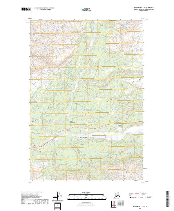
2023 Map of Anchorage D-4 SW
USGS Topo · Published 2023About this map
Chickaloon sits at the northern edge of the Matanuska Valley, where the Chickaloon River meets the braided channels of the Matanuska River. This modern survey illustrates a landscape defined by dramatic elevation changes, from the heights of Castle Mtn and Puddingstone Hill down to the river basin. The settlement pattern follows the Glenn Highway corridor, which serves as the primary artery for the region, supported by local infrastructure like Chickaloon Drive and the Chickaloon Branch Rd. Remote aviation access is highlighted by the presence of the King Ranch Airport and the Castle Mountain Airstrip near Harrison Lake. Numerous tributaries including Coal Creek, Saw Mill Creek, and Doone Creek drain the surrounding mountains, while Bonnie Lake provides a notable landmark in the eastern portion of the quadrangle.
Find a feature on this map
27 named features on this map. Tap any name to fly to it.
Don’t see what you’re looking for? This feature index may not catch every label — zoom into the map to look around manually.
Map Details
Editions of this 2023 Anchorage D-4 SW Map
This is the sole edition of this map. No revisions or reprints were ever made.
Other maps of this area

1948 · Anchorage D-4
USGS Topo · 1:63,360

1949 · Anchorage D-5
USGS Topo · 1:63,360

1951 · Anchorage
USGS Topo · 1:250,000

1951 · Anchorage C-5
USGS Topo · 1:63,360

1952 · Anchorage D-5
USGS Topo · 1:63,360

1952 · Anchorage D-4
USGS Topo · 1:63,360

1952 · Anchorage C-5
USGS Topo · 1:63,360

1960 · Anchorage C-5
USGS Topo · 1:63,360

1960 · Anchorage C-4
USGS Topo · 1:63,360

1962 · Anchorage
USGS Topo · 1:250,000