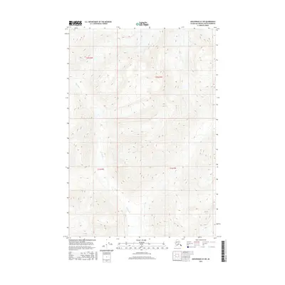
2016 Map of Anchorage D-5 NE
USGS Topo · Published 2016About this map
Kings River carves a deep path through the high-elevation terrain of the Talkeetna Mountains in this 2016 survey. The landscape is defined by its dramatic relief, with contour lines marking steep ridges and narrow valleys that drain toward the south and west. This portion of the Matanuska-Susitna Borough is largely unpopulated, with no roads or permanent structures indicated, reflecting a wilderness state dominated by natural drainage patterns. The map provides precise surveying of the Public Land Survey System grid, specifically identifying t22n r4e, t22n r5e, t21n r4e, and t21n r5e. These designations delineate the legal boundaries across the high peaks and alpine basins, where glaciers and snowfields feed the local river system.
Find a feature on this map
5 named features on this map. Tap any name to fly to it.
Don’t see what you’re looking for? This feature index may not catch every label — zoom into the map to look around manually.
Map Details
Editions of this 2016 Anchorage D-5 NE Map
This is the sole edition of this map. No revisions or reprints were ever made.
Other maps of this area

1948 · Anchorage D-4
USGS Topo · 1:63,360

1949 · Anchorage D-5
USGS Topo · 1:63,360

1949 · Talkeetna Mountains A-4
USGS Topo · 1:63,360

1950 · Talkeetna Mountains
USGS Topo · 1:250,000

1951 · Anchorage
USGS Topo · 1:250,000

1951 · Talkeetna Mountains A-3
USGS Topo · 1:63,360

1952 · Anchorage D-5
USGS Topo · 1:63,360

1952 · Anchorage D-4
USGS Topo · 1:63,360
1952 · Talkeetna Mountains A-3
USGS Topo · 1:63,360
1954 · Talkeetna Mountains A-4
USGS Topo · 1:63,360