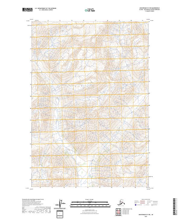
2023 Map of Anchorage D-5 NE
USGS Topo · Published 2023About this map
Kings River carves a deep path through this portion of the Matanuska-Susitna region, flowing southward across several township boundaries including t22n r4e and t21n r4e. The landscape is dominated by high-elevation terrain, with the river serving as the primary geographic corridor through the mountainous topography of the Talkeetna Mountains range. The lack of infrastructure or developed settlements on this 2023 survey emphasizes the wilderness character of the area, providing a clear record of the natural drainage patterns and land divisions within the t22n r5e and t21n r5e survey blocks. For those studying the hydrology of the Matanuska Valley watershed, the map offers precise data on the tributaries and elevation contours that feed into the main river channel.
Find a feature on this map
5 named features on this map. Tap any name to fly to it.
Don’t see what you’re looking for? This feature index may not catch every label — zoom into the map to look around manually.
Map Details
Editions of this 2023 Anchorage D-5 NE Map
This is the sole edition of this map. No revisions or reprints were ever made.
Other maps of this area

1948 · Anchorage D-4
USGS Topo · 1:63,360

1949 · Anchorage D-5
USGS Topo · 1:63,360

1949 · Talkeetna Mountains A-4
USGS Topo · 1:63,360

1950 · Talkeetna Mountains
USGS Topo · 1:250,000

1951 · Anchorage
USGS Topo · 1:250,000

1951 · Talkeetna Mountains A-3
USGS Topo · 1:63,360

1952 · Anchorage D-5
USGS Topo · 1:63,360

1952 · Anchorage D-4
USGS Topo · 1:63,360
1952 · Talkeetna Mountains A-3
USGS Topo · 1:63,360
1954 · Talkeetna Mountains A-4
USGS Topo · 1:63,360