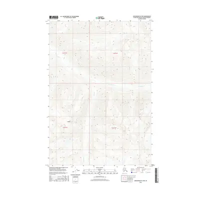
2016 Map of Anchorage D-6 NW
USGS Topo · Published 2016About this map
Kashwitna River cuts a wide path through this high-elevation Alaskan terrain within the Matanuska-Susitna Borough. The landscape is defined by its steep relief and glacial drainage patterns, where Bartholf Cr feeds into the larger river system from the south. The settlement of Willow appears in the southwestern portion of the sheet, providing a point of reference for the region's human geography amidst the expansive natural features. Surveyed in 2016, this map provides precise topographic detail of the township and range lines, including t22n r1e and t21n r2e, which are essential for property research and understanding the Bureau of Land Management's survey framework in the Alaskan interior.
Find a feature on this map
7 named features on this map. Tap any name to fly to it.
Don’t see what you’re looking for? This feature index may not catch every label — zoom into the map to look around manually.
Map Details
Editions of this 2016 Anchorage D-6 NW Map
This is the sole edition of this map. No revisions or reprints were ever made.
Other maps of this area

1949 · Anchorage D-7
USGS Topo · 1:63,360

1950 · Talkeetna Mountains
USGS Topo · 1:250,000

1950 · Anchorage D-6
USGS Topo · 1:63,360

1950 · Talkeetna Mountains A-5
USGS Topo · 1:63,360

1951 · Anchorage
USGS Topo · 1:250,000

1951 · Anchorage D-7
USGS Topo · 1:63,360

1952 · Anchorage D-7
USGS Topo · 1:63,360

1952 · Anchorage D-6
USGS Topo · 1:63,360
1952 · Talkeetna Mountains A-5
USGS Topo · 1:63,360

1954 · Talkeetna Mountains
USGS Topo · 1:250,000