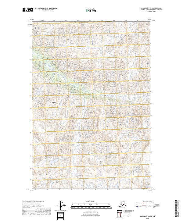
2023 Map of Anchorage D-6 NW
USGS Topo · Published 2023About this map
The Kashwitna River cuts a wide path through this interior Alaska landscape, defining the central geography of this section of the Matanuska-Susitna Borough. The terrain is marked by the sharp relief of high mountain ridges and deep valleys, where Bartholf Creek flows southward through the eastern survey sections. While the area is largely dominated by unpopulated alpine territory, the label for Willow appears in the western portion of the map, indicating the outskirts or extended vicinity of this historic railbelt community. The map provides a look at the Public Land Survey System grid across T22N R1E and T21N R2E, highlighting how federal land divisions were imposed upon the complex river systems and high-elevation topography of the Talkeetna Mountains fringe in the early twenty-first century.
Find a feature on this map
7 named features on this map. Tap any name to fly to it.
Don’t see what you’re looking for? This feature index may not catch every label — zoom into the map to look around manually.
Map Details
Editions of this 2023 Anchorage D-6 NW Map
This is the sole edition of this map. No revisions or reprints were ever made.
Other maps of this area

1949 · Anchorage D-7
USGS Topo · 1:63,360

1950 · Talkeetna Mountains
USGS Topo · 1:250,000

1950 · Anchorage D-6
USGS Topo · 1:63,360

1950 · Talkeetna Mountains A-5
USGS Topo · 1:63,360

1951 · Anchorage
USGS Topo · 1:250,000

1951 · Anchorage D-7
USGS Topo · 1:63,360

1952 · Anchorage D-7
USGS Topo · 1:63,360

1952 · Anchorage D-6
USGS Topo · 1:63,360
1952 · Talkeetna Mountains A-5
USGS Topo · 1:63,360

1954 · Talkeetna Mountains
USGS Topo · 1:250,000