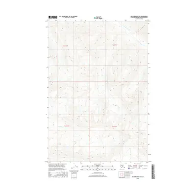
2016 Map of Anchorage D-7 NE
USGS Topo · Published 2016About this map
Kashwitna River defines the northern reaches of this Alaskan interior landscape, flowing through a region where elevation changes are sharp and immediate. The terrain here is marked by the deep glacial drainage patterns typical of the Matanuska-Susitna area, with the southern portion of the map drained by Little Willow Cr. The cartography reveals a wilderness nearly devoid of human infrastructure, instead highlighting the complex hydrography and high-altitude contours that define the Talkeetna Mountains' fringe. This survey provides a baseline of the untouched hydrology and topographical relief before significant modern alteration, recording the natural state of these vital waterways as they appeared in the early 21st century.
Find a feature on this map
6 named features on this map. Tap any name to fly to it.
Don’t see what you’re looking for? This feature index may not catch every label — zoom into the map to look around manually.
Map Details
Editions of this 2016 Anchorage D-7 NE Map
This is the sole edition of this map. No revisions or reprints were ever made.
Other maps of this area

1949 · Anchorage D-7
USGS Topo · 1:63,360

1950 · Talkeetna Mountains
USGS Topo · 1:250,000

1950 · Anchorage D-6
USGS Topo · 1:63,360

1950 · Talkeetna Mountains A-5
USGS Topo · 1:63,360

1951 · Anchorage
USGS Topo · 1:250,000

1951 · Anchorage D-7
USGS Topo · 1:63,360

1952 · Anchorage D-7
USGS Topo · 1:63,360

1952 · Anchorage D-6
USGS Topo · 1:63,360
1952 · Talkeetna Mountains A-5
USGS Topo · 1:63,360

1954 · Talkeetna Mountains
USGS Topo · 1:250,000