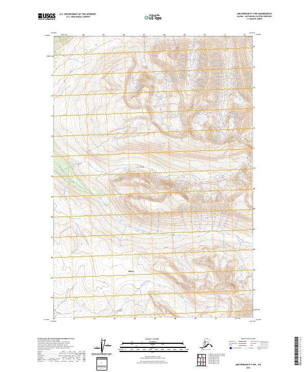
2023 Map of Anchorage D-7 NW
USGS Topo · Published 2023About this map
Willow anchors this portion of the Matanuska-Susitna region, situated in a high-elevation environment defined by a dense network of watercourses and topographic relief. The hydrology of the area is primarily shaped by the winding path of Little Willow Creek, which cuts through the northwestern and eastern sections of the quadrangle. Further south, Sevenmile Creek and Canyon Creek delineate the lower drainage patterns, flowing between steep contour intervals that indicate significant elevation changes across the township and range boundaries. This map provides a detailed look at the public land survey system divisions, including t22n r2w and t21n r1w, illustrating how the wilderness is partitioned in this Alaskan interior. The lack of extensive road infrastructure highlighted in the road classification legend underscores the isolation and natural state of the terrain during this early 21st-century survey.
Find a feature on this map
8 named features on this map. Tap any name to fly to it.
Don’t see what you’re looking for? This feature index may not catch every label — zoom into the map to look around manually.
Map Details
Editions of this 2023 Anchorage D-7 NW Map
This is the sole edition of this map. No revisions or reprints were ever made.
Other maps of this area

1949 · Anchorage D-7
USGS Topo · 1:63,360

1949 · Anchorage D-8
USGS Topo · 1:63,360

1950 · Talkeetna Mountains
USGS Topo · 1:250,000

1950 · Talkeetna Mountains A-6
USGS Topo · 1:63,360

1950 · Talkeetna Mountains A-5
USGS Topo · 1:63,360

1951 · Anchorage
USGS Topo · 1:250,000

1951 · Anchorage D-8
USGS Topo · 1:63,360

1951 · Anchorage D-7
USGS Topo · 1:63,360

1952 · Anchorage D-7
USGS Topo · 1:63,360

1952 · Anchorage D-8
USGS Topo · 1:63,360