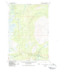
1949 Map of Anchorage D-8
USGS Topo · Published 1987About this map
The Kashwitna River and its North Fork dominate this landscape in the Matanuska-Susitna Borough, revealing a complex drainage system before significant modern development. The southern portion of the map is defined by the convergence of several waterways including Willow Creek and Deception Creek, where the local transportation network begins to take shape. While much of the terrain is defined by water, human transit is represented by the Willow Road and the Winter Trail, providing insight into the seasonal access patterns of the mid-century Alaskan interior.
Find a feature on this map
22 named features on this map. Tap any name to fly to it.
Don’t see what you’re looking for? This feature index may not catch every label — zoom into the map to look around manually.
Map Details
Editions of this 1949 Anchorage D-8 Map
3 editions found
Other maps of this area

1949 · Tyonek
USGS Topo · 1:250,000

1949 · Anchorage D-7
USGS Topo · 1:63,360

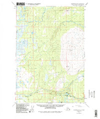
1949 · Anchorage D-8
USGS Topo · 1:63,360

1950 · Talkeetna Mountains
USGS Topo · 1:250,000

1950 · Talkeetna
USGS Topo · 1:250,000

1950 · Anchorage C-8
USGS Topo · 1:63,360

1950 · Anchorage C-7
USGS Topo · 1:63,360

1950 · Talkeetna Mountains A-6
USGS Topo · 1:63,360

1951 · Talkeetna
USGS Topo · 1:250,000

1951 · Anchorage
USGS Topo · 1:250,000