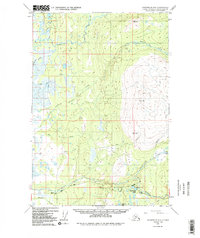
1949 Map of Anchorage D-8
USGS Topo · Published 1987About this map
Willow Creek and the Kashwitna River define the drainage patterns of this Alaskan landscape, captured during a 1949 photogrammetric survey and later revised in the 1980s. The area is characterized by a dense network of watercourses including Little Willow Creek, Iron Creek, and Rogers Creek. While much of the terrain is dominated by natural features and survey markers like VABM 8168 Willow, early transportation infrastructure is visible in the southern portion of the sheet. The presence of the Willow Road and a Winter Trail near Twentymile Lake and Teakwood Lake highlights the seasonal nature of travel and access in the Matanuska-Susitna region during the mid-20th century. These routes served as vital links before the modern expansion of the regional highway system.
Find a feature on this map
21 named features on this map. Tap any name to fly to it.
Don’t see what you’re looking for? This feature index may not catch every label — zoom into the map to look around manually.
Map Details
Editions of this 1949 Anchorage D-8 Map
3 editions found
Other maps of this area

1949 · Tyonek
USGS Topo · 1:250,000

1949 · Anchorage D-7
USGS Topo · 1:63,360

1949 · Anchorage D-8
USGS Topo · 1:63,360

1950 · Talkeetna Mountains
USGS Topo · 1:250,000

1950 · Talkeetna
USGS Topo · 1:250,000

1950 · Anchorage C-8
USGS Topo · 1:63,360

1950 · Anchorage C-7
USGS Topo · 1:63,360

1950 · Talkeetna Mountains A-6
USGS Topo · 1:63,360

1951 · Talkeetna
USGS Topo · 1:250,000

1951 · Anchorage
USGS Topo · 1:250,000