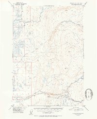
1952 Map of Anchorage D-8
USGS Topo · Published 1952About this map
Kashwitna River and its north fork dominate the northern reaches of this landscape, carving through the transition from valley floor to the prominent peaks of the Talkeetna Mountains. In this early 1950s survey, the drainage patterns of Willow Creek, Little Willow Creek, and Rogers Creek reveal a territory largely defined by its waterways and elevation changes. Evidence of early interior travel and survival is marked by a Cabin in the north and another near Purches Creek, alongside the presence of a Sled Road and an early Road corridor in the south. High points like VABM 3168 Willow and VABM 2450 Kash provide fixed surveying benchmarks across the ridges. The intricate network of smaller streams like Deception Creek and Peters Creek highlights the complex hydrology of the Matanuska-Susitna region during this era of post-war exploration and mapping.
Find a feature on this map
15 named features on this map. Tap any name to fly to it.
Don’t see what you’re looking for? This feature index may not catch every label — zoom into the map to look around manually.
Map Details
Editions of this 1952 Anchorage D-8 Map
2 editions found

Other maps of this area

1949 · Tyonek
USGS Topo · 1:250,000

1949 · Anchorage D-7
USGS Topo · 1:63,360

1949 · Anchorage D-8
USGS Topo · 1:63,360

1950 · Talkeetna Mountains
USGS Topo · 1:250,000

1950 · Talkeetna
USGS Topo · 1:250,000

1950 · Anchorage C-8
USGS Topo · 1:63,360

1950 · Anchorage C-7
USGS Topo · 1:63,360

1950 · Talkeetna Mountains A-6
USGS Topo · 1:63,360

1951 · Talkeetna
USGS Topo · 1:250,000

1951 · Anchorage
USGS Topo · 1:250,000