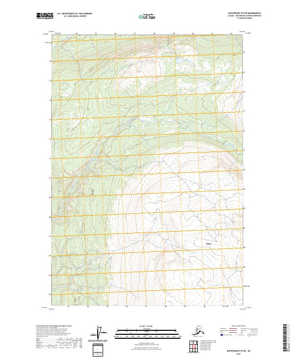
2023 Map of Anchorage D-8 NE
USGS Topo · Published 2023About this map
Kashwitna River defines the northwest corner of this Alaska landscape, where the terrain transitions toward the settlement of Willow. The geography is characterized by the winding path of Little Willow Creek, which cuts diagonally across the center of the survey. Mapping of the Public Land Survey System grids, including t22n r3w and t21n r2w, reveals a landscape where modern boundaries meet the natural water systems of the Matanuska-Susitna Borough. This 2023 edition provides a high-resolution view of the local drainage patterns and topography as they exist today, capturing the hydrological network that has shaped the growth and infrastructure around the Willow community.
Find a feature on this map
7 named features on this map. Tap any name to fly to it.
Don’t see what you’re looking for? This feature index may not catch every label — zoom into the map to look around manually.
Map Details
Editions of this 2023 Anchorage D-8 NE Map
This is the sole edition of this map. No revisions or reprints were ever made.
Other maps of this area

1949 · Anchorage D-7
USGS Topo · 1:63,360

1949 · Anchorage D-8
USGS Topo · 1:63,360

1950 · Talkeetna Mountains
USGS Topo · 1:250,000

1950 · Talkeetna Mountains A-6
USGS Topo · 1:63,360

1951 · Anchorage
USGS Topo · 1:250,000

1951 · Anchorage D-8
USGS Topo · 1:63,360

1951 · Anchorage D-7
USGS Topo · 1:63,360

1952 · Anchorage D-7
USGS Topo · 1:63,360

1952 · Anchorage D-8
USGS Topo · 1:63,360
1952 · Talkeetna Mountains A-6
USGS Topo · 1:63,360