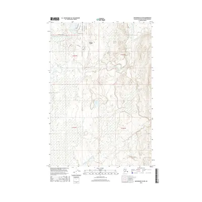
2016 Map of Anchorage D-8 NW
USGS Topo · Published 2016About this map
Susitna North serves as the focal point for this 2016 topographical record of the Matanuska-Susitna region in Alaska. The landscape is defined by the winding paths of the Kashwitna River and Little Willow Creek, which navigate through the complex hydrology of the Alaskan interior. Significant water bodies such as Sunset Lake and smaller tributaries like Caswell Creek and 190 Mile Cr are meticulously documented. The development of the area is illustrated by a growing network of residential roads, including Silver Salmon Drive, Cutthroat Drive, and Bendapole Road. Other local streets like Dolly Varden Drive, Dryfly Street, and Passthebait Avenue further indicate the area's transition. Local historians and researchers can examine land divisions and township boundaries, such as t22n r4w and t21n r3w, to understand the spatial organization and growth of this sub-arctic community.
Find a feature on this map
22 named features on this map. Tap any name to fly to it.
Don’t see what you’re looking for? This feature index may not catch every label — zoom into the map to look around manually.
Map Details
Editions of this 2016 Anchorage D-8 NW Map
This is the sole edition of this map. No revisions or reprints were ever made.
Other maps of this area

1949 · Tyonek
USGS Topo · 1:250,000

1949 · Anchorage D-8
USGS Topo · 1:63,360

1950 · Talkeetna Mountains
USGS Topo · 1:250,000

1950 · Talkeetna
USGS Topo · 1:250,000

1950 · Talkeetna Mountains A-6
USGS Topo · 1:63,360

1951 · Talkeetna
USGS Topo · 1:250,000

1951 · Anchorage
USGS Topo · 1:250,000

1951 · Tyonek
USGS Topo · 1:250,000

1951 · Anchorage D-8
USGS Topo · 1:63,360

1952 · Tyonek D-1
USGS Topo · 1:63,360