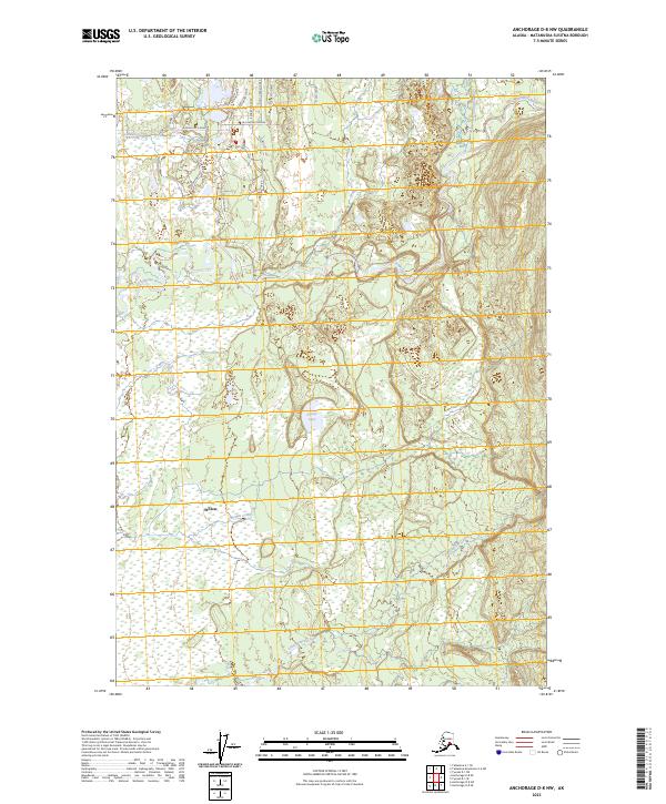
2023 Map of Anchorage D-8 NW
USGS Topo · Published 2023About this map
The settlement of Willow anchors this portion of the Matanuska-Susitna Borough, where a network of residential roads with names inspired by local angling culture—such as Silver Salmon Drive, Cutthroat Drive, and Passthebait Avenue—spreads through the boreal landscape. This 2023 survey illustrates the modern residential development pattern north of Willow, particularly around the Caswell Loop and Caswell Creek Drive area. The terrain is defined by the braided path of the Kashwitna River and numerous smaller drainages including Caswell Creek, Little Willow Creek, and the curiously named 197 1/2 Mile Creek. Sunset Lake sits at the heart of this wetlands-heavy region, providing a focal point for the surrounding local roads like Bald Eagle Way and Deep Woods Way.
Find a feature on this map
26 named features on this map. Tap any name to fly to it.
Don’t see what you’re looking for? This feature index may not catch every label — zoom into the map to look around manually.
Map Details
Editions of this 2023 Anchorage D-8 NW Map
This is the sole edition of this map. No revisions or reprints were ever made.
Other maps of this area

1949 · Tyonek
USGS Topo · 1:250,000

1949 · Anchorage D-8
USGS Topo · 1:63,360

1950 · Talkeetna Mountains
USGS Topo · 1:250,000

1950 · Talkeetna
USGS Topo · 1:250,000

1950 · Talkeetna Mountains A-6
USGS Topo · 1:63,360

1951 · Talkeetna
USGS Topo · 1:250,000

1951 · Anchorage
USGS Topo · 1:250,000

1951 · Tyonek
USGS Topo · 1:250,000

1951 · Anchorage D-8
USGS Topo · 1:63,360

1952 · Tyonek D-1
USGS Topo · 1:63,360