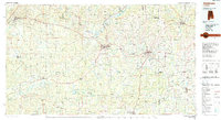
1986 Map of Andalusia
USGS Topo · Published 1989About this map
Conecuh River and its numerous tributaries, including Patsaliga Creek and Pigeon Creek, define the drainage patterns of this South Alabama region during the mid-1980s. The landscape is characterized by a balance of industrial infrastructure and protected natural spaces, with the Conecuh National Forest spanning the southern reaches and the Miller State Wildlife Management Area to the west. Central to the map is the city of Andalusia, serving as a hub for the surrounding rural communities.
Find a feature on this map
111 named features on this map. Tap any name to fly to it.
Don’t see what you’re looking for? This feature index may not catch every label — zoom into the map to look around manually.
Map Details
Editions of this 1986 Andalusia Map
2 editions found
Other maps of this area

1942 · Enterprise
USGS Topo · 1:125,000

1943 · Jay
USGS Topo · 1:62,500

1948 · Munson
USGS Topo · 1:62,500

1948 · Brundidge
USGS Topo · 1:62,500

1949 · Glendale
USGS Topo · 1:62,500

1949 · Crestview
USGS Topo · 1:62,500

1949 · Laurel Hill
USGS Topo · 1:62,500

1949 · Hobbs Crossroads
USGS Topo · 1:24,000

1950 · Hobbs Cross Roads
USGS Topo · 1:24,000

1950 · Laurel Hill
USGS Topo · 1:62,500