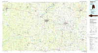
1986 Map of Andalusia
USGS Topo · Published 1986About this map
Andalusia and the Covington County Courthouse serve as the hub for this South Alabama region during the mid-1980s. The landscape is defined by the convergence of major waterways, including the Conecuh River and Patsaliga Creek, which feed into Gantt Lake and Point A Lake. These waters, along with the Yellow River to the south, supported a timber and agricultural economy reflected in the dense network of rural settlements like River Falls, Red Level, and Cohassett.
Find a feature on this map
110 named features on this map. Tap any name to fly to it.
Don’t see what you’re looking for? This feature index may not catch every label — zoom into the map to look around manually.
Map Details
Editions of this 1986 Andalusia Map
2 editions found
Other maps of this area

1942 · Enterprise
USGS Topo · 1:125,000

1943 · Jay
USGS Topo · 1:62,500

1948 · Munson
USGS Topo · 1:62,500

1948 · Brundidge
USGS Topo · 1:62,500

1949 · Glendale
USGS Topo · 1:62,500

1949 · Crestview
USGS Topo · 1:62,500

1949 · Laurel Hill
USGS Topo · 1:62,500

1949 · Hobbs Crossroads
USGS Topo · 1:24,000

1950 · Hobbs Cross Roads
USGS Topo · 1:24,000

1950 · Laurel Hill
USGS Topo · 1:62,500