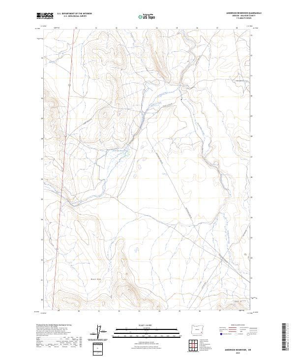
2023 Map of Anderson Reservoir
USGS Topo · Published 2023About this map
Anderson Reservoir serves as a central hydrological landmark in this high-desert portion of Malheur County, where the management of water defines the land use. The map illustrates a network of engineered irrigation, including Anderson Ditch and Crutcher Ditch, which redirect flow across a landscape shaped by seasonal drainages like Rattlesnake Creek and Crooked Creek. This reliance on water infrastructure suggests the long-standing importance of ranching and livestock in the region, evidenced by access routes such as Gilbert Ranch Rd. To the south, the terrain rises toward the Black Hills and Red Hills, while the presence of the Old Ion Hwy provides a historical trace of earlier transportation corridors through this part of the Oregon desert.
Find a feature on this map
21 named features on this map. Tap any name to fly to it.
Don’t see what you’re looking for? This feature index may not catch every label — zoom into the map to look around manually.
Map Details
Editions of this 2023 Anderson Reservoir Map
This is the sole edition of this map. No revisions or reprints were ever made.
Other maps of this area

1955 · Jordan Valley
USGS Topo · 1:250,000

1957 · Jordan Valley
USGS Topo · 1:250,000

1958 · Jordan Valley
USGS Topo · 1:250,000

1972 · Palomino Hills
USGS Topo · 1:24,000

1972 · Rome
USGS Topo · 1:24,000
1972 · Burns Junction
USGS Topo · 1:24,000

1979 · Bowden Ranch
USGS Topo · 1:24,000

1979 · Anderson Reservoir
USGS Topo · 1:24,000

1979 · Flat Top Mtn SE
USGS Topo · 1:24,000
1979 · The Basin
USGS Topo · 1:24,000