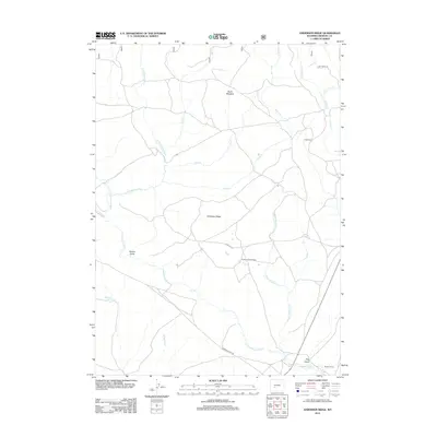
2012 Map of Anderson Ridge
USGS Topo · Published 2012About this map
Anderson Ridge anchors this high-country landscape in Fremont County, where the headwaters of the Sweetwater River and its various forks, such as the E Sweetwater River, wind through open range and meadows. The presence of the Lander Cutoff Rd provides a direct connection to the historic emigrant trail system, cutting across the southern portion of the sheet near Fog Gulch. This area reflects a long-standing ranching and homesteading heritage, evidenced by the Anderson Homestead and Jack Ranch. Notable water management and transit features including the Rinne Ditch and the Pine Creek Trl indicate how this terrain has been utilized for irrigation and movement. From the quiet expanse of Burnt Meadow to the isolated Shelter House, the map documents a territory defined by high-altitude drainages and historical passage.
Find a feature on this map
22 named features on this map. Tap any name to fly to it.
Don’t see what you’re looking for? This feature index may not catch every label — zoom into the map to look around manually.
Map Details
Editions of this 2012 Anderson Ridge Map
This is the sole edition of this map. No revisions or reprints were ever made.
Other maps of this area

1953 · Louis Lake
USGS Topo · 1:24,000

1953 · South Pass City
USGS Topo · 1:24,000

1953 · Christina Lake
USGS Topo · 1:24,000

1955 · Lander
USGS Topo · 1:250,000

1958 · Lander
USGS Topo · 1:250,000

1958 · Parting of the Ways
USGS Topo · 1:62,500

1958 · Hay Meadow Reservoir
USGS Topo · 1:24,000

1958 · Pacific Springs
USGS Topo · 1:24,000

1958 · Dickie Springs
USGS Topo · 1:24,000

1961 · Lander
USGS Topo · 1:250,000