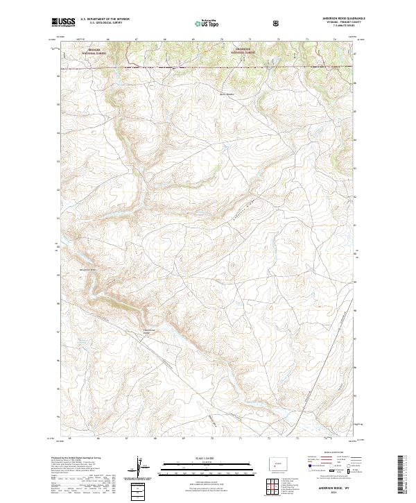
2021 Map of Anderson Ridge
USGS Topo · Published 2021About this map
The Continental Divide defines the topography of this high-elevation landscape in Fremont County, where the headwaters of several major Western drainages begin their journey. The drainage patterns are intricate, with the Sweetwater River and its tributary E Sweetwater River flowing through the southern half of the sheet, while northern waters like Jack Cr and Little Pine Cr navigate the high country. Human activity is largely defined by public lands, as the map captures the boundary between the Bridger National Forest and the Shoshone National Forest. Historical transit is represented by the path of the Lander Cutoff Rd, a significant route for early western migration. Irrigation efforts in this arid environment are visible through features like the Rinker Ditch, which draws from Pine Cr to support the high meadows including Burnt Meadow.
Find a feature on this map
28 named features on this map. Tap any name to fly to it.
Don’t see what you’re looking for? This feature index may not catch every label — zoom into the map to look around manually.
Map Details
Editions of this 2021 Anderson Ridge Map
This is the sole edition of this map. No revisions or reprints were ever made.
Other maps of this area

1953 · Louis Lake
USGS Topo · 1:24,000

1953 · South Pass City
USGS Topo · 1:24,000

1953 · Christina Lake
USGS Topo · 1:24,000

1955 · Lander
USGS Topo · 1:250,000

1958 · Lander
USGS Topo · 1:250,000

1958 · Parting of the Ways
USGS Topo · 1:62,500

1958 · Hay Meadow Reservoir
USGS Topo · 1:24,000

1958 · Pacific Springs
USGS Topo · 1:24,000

1958 · Dickie Springs
USGS Topo · 1:24,000

1961 · Lander
USGS Topo · 1:250,000