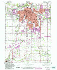
1961 Map of Anderson South
USGS Topo · Published 1994About this map
The White River and the Conrail rail lines anchor this detailed study of the industrial and residential core of Anderson during its mid-century growth. The map documents the city's southward expansion into Fall Creek and Adams townships, showing established neighborhoods like Edgewood and River Forest alongside the sprawling Mounds State Park. Educational and civic development is well-represented, from the Anderson College campus to numerous local institutions such as Madison Heights High Sch and Anderson High Sch. A high density of cemeteries, including Maplewood Cemetery and the Anderson Memorial Park, provides valuable data for genealogists. The southern portion of the sheet transitions to a more agrarian landscape, punctuated by smaller communities like Pendleton and Huntsville, where Fall Creek winds through the terrain near the Grovelawn Cem.
Find a feature on this map
97 named features on this map. Tap any name to fly to it.
Don’t see what you’re looking for? This feature index may not catch every label — zoom into the map to look around manually.
Map Details
Editions of this 1961 Anderson South Map
4 editions found

Other maps of this area

1952 · Ingalls
USGS Topo · 1:24,000

1952 · Anderson
USGS Topo · 1:24,000

1953 · Pendleton
USGS Topo · 1:24,000

1953 · Lapel
USGS Topo · 1:24,000

1953 · Cincinnati
USGS Topo · 1:250,000

1953 · Muncie
USGS Topo · 1:250,000

1956 · Muncie
USGS Topo · 1:250,000

1957 · Cincinnati
USGS Topo · 1:250,000

1960 · Gilman
USGS Topo · 1:24,000

1960 · Middletown
USGS Topo · 1:24,000