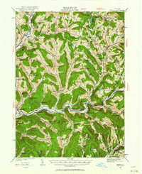
1922 Map of Andes
USGS Topo · Published 1963About this map
The West Branch Delaware River and East Branch Delaware River valleys define this 1922 portrait of Delaware County, shortly before reservoir projects would reshape the local landscape. Along the winding New York Ontario and Western RR, small dairy-era hamlets like Delancey and Hamden serve as local hubs, while dozens of district schools—such as the Gladstone Hollow School and Bovina Hollow School—pepper the steep hollows between Campbell Mountain and the Devils Backbone. This survey documents riverside communities including Shavertown, Pepacton, and Union Grove in their original locations, providing an essential record of family-named hollows and local landmarks like the Cabin Hill Church before mid-century changes. The terrain is a dense network of private roads and farm paths, including Farmers Hill Road, connecting isolated farmsteads to the larger villages of Andes and Downsville.
Find a feature on this map
135 named features on this map. Tap any name to fly to it.
Don’t see what you’re looking for? This feature index may not catch every label — zoom into the map to look around manually.
Map Details
Editions of this 1922 Andes Map
2 editions found

Other maps of this area

1901 · Margaretville
USGS Topo · 1:62,500

1904 · Hobart
USGS Topo · 1:62,500

1904 · Margaretville
USGS Topo · 1:62,500

1909 · Delhi
USGS Topo · 1:62,500

1910 · Neversink
USGS Topo · 1:62,500

1911 · Delhi
USGS Topo · 1:62,500

1915 · Oneonta
USGS Topo · 1:62,500

1918 · Oneonta
USGS Topo · 1:62,500

1920 · Long Eddy
USGS Topo · 1:62,500

1921 · Long Eddy
USGS Topo · 1:48,000