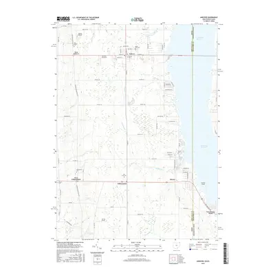
2016 Map of Andover
USGS Topo · Published 2016About this map
Pymatuning Reservoir dominates the eastern edge of this landscape, defining the state boundary between Ohio and Pennsylvania. Along the shoreline and inland, the rural character of Ashtabula County is preserved through a network of township roads and scattered agricultural settlements. The village of Andover serves as a primary hub, while smaller hamlets like Simons and Williamsfield anchor the southern reaches. Local history is deeply etched into the land at sites like Owens Mound and a high concentration of burial grounds, including West Andover Cem, Maple Grove Cem, and West Lawn Cem. Small-scale aviation is represented by Riceland Aerodrome and Hal Joy Airfield, while the hydrology of the region is defined by winding tributaries such as McMichael Cr and Stratton Cr that feed toward the reservoir basin.
Find a feature on this map
74 named features on this map. Tap any name to fly to it.
Don’t see what you’re looking for? This feature index may not catch every label — zoom into the map to look around manually.
Map Details
Editions of this 2016 Andover Map
This is the sole edition of this map. No revisions or reprints were ever made.
Other maps of this area

1905 · Andover
USGS Topo · 1:48,000

1906 · Linesville
USGS Topo · 1:62,500

1907 · Andover
USGS Topo · 1:62,500

1907 · Kinsman
USGS Topo · 1:62,500

1908 · Shenango
USGS Topo · 1:62,500

1908 · Linesville
USGS Topo · 1:62,500

1950 · Cleveland
USGS Topo · 1:250,000

1956 · Cleveland
USGS Topo · 1:250,000

1958 · Greensville West
USGS Topo · 1:24,000

1959 · Hartstown
USGS Topo · 1:24,000