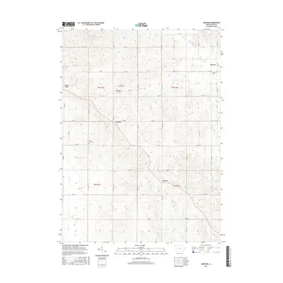
2015 Map of Andover
USGS Topo · Published 2015About this map
Andover and Goose Lake anchor this rural Clinton County landscape, where a dense network of county roads like 160th St and 390th Ave divides the terrain into traditional agricultural sections. The map records several localized communities including Bryant, Tenmile, and Sixmile, the latter two suggesting their distances along early travel corridors. Waterways such as the Elk River in the northeast and the meandering Brophy Creek in the southwest define the low-lying drainage patterns of the area. For those tracing family histories, several burial sites are documented across the township, including Andover Cemetery, Center Grove Cemetery, and Saint Marys Catholic Cemetery near Bryant. The placement of these cemeteries and small settlements reveals the enduring settlement patterns of eastern Iowa in the early 21st century.
Find a feature on this map
43 named features on this map. Tap any name to fly to it.
Don’t see what you’re looking for? This feature index may not catch every label — zoom into the map to look around manually.
Map Details
Editions of this 2015 Andover Map
This is the sole edition of this map. No revisions or reprints were ever made.
Other maps of this area

1891 · Clinton
USGS Topo · 1:62,500

1892 · Goose Lake
USGS Topo · 1:62,500

1892 · Savanna
USGS Topo · 1:62,500

1894 · Goose Lake
USGS Topo · 1:62,500

1894 · Clinton
USGS Topo · 1:62,500

1899 · Clinton
USGS Topo · 1:125,000

1935 · Miles
USGS Topo · 1:62,500

1941 · Miles
USGS Topo · 1:62,500

1952 · Clinton
USGS Topo · 1:62,500

1952 · Savanna
USGS Topo · 1:62,500