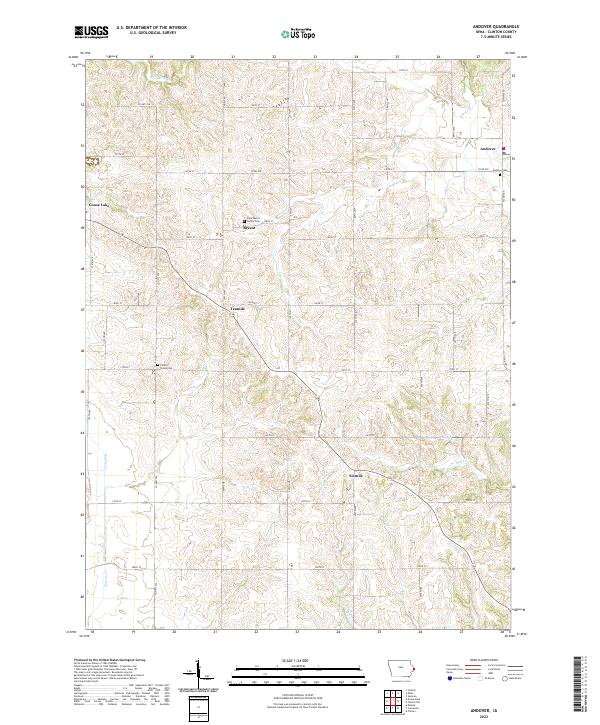
2022 Map of Andover
USGS Topo · Published 2022About this map
Andover and its surrounding rural townships in Clinton County are defined by a network of creeks and small agricultural hubs. The landscape is carved by the Elk River in the northeast and Mill Cr in the southeast, with local transport routes such as Co Rd E50 connecting the scattered communities of Bryant and Goose Lake. This 2022 survey illustrates the persistent rural structure of the region, where family history is preserved at sites like Saint Mary's Family Cem and the Andover Cem. The arrangement of small named settlements like Tenmile and Sixmile along the highway corridors reflects the early 21st-century distribution of residential and farming clusters within the established sections of t83n r5e and t83n r6e.
Find a feature on this map
34 named features on this map. Tap any name to fly to it.
Don’t see what you’re looking for? This feature index may not catch every label — zoom into the map to look around manually.
Map Details
Editions of this 2022 Andover Map
This is the sole edition of this map. No revisions or reprints were ever made.
Other maps of this area

1891 · Clinton
USGS Topo · 1:62,500

1892 · Goose Lake
USGS Topo · 1:62,500

1892 · Savanna
USGS Topo · 1:62,500

1894 · Goose Lake
USGS Topo · 1:62,500

1894 · Clinton
USGS Topo · 1:62,500

1899 · Clinton
USGS Topo · 1:125,000

1935 · Miles
USGS Topo · 1:62,500

1941 · Miles
USGS Topo · 1:62,500

1952 · Clinton
USGS Topo · 1:62,500

1952 · Savanna
USGS Topo · 1:62,500