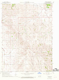
1967 Map of Andover
USGS Topo · Published 1969About this map
Andover and Bryant anchor this mid-century portrait of Clinton County's agricultural landscape, where the drainage patterns of the Elk River and its tributaries define the township boundaries. The map illustrates a transitional period in regional infrastructure, notably marking a Railroad Grade that underscores the shifting transport networks of the late 1960s. Education and community life are grounded by landmarks like the Northeast Community High Sch and the Center Grove Cem, while the industrial presence of Goose Lake Quarry and another Quarry near the Elk River signify local resource extraction. Waterways such as Spring Creek, Sixmile Creek, and Little Mill Creek carve through the terrain, illustrating the natural irrigation system that supported the area's rural development. Further south, the settlement of Tenmile and a prominent Radio Tower serve as navigational and communication anchors for the surrounding countryside.
Find a feature on this map
19 named features on this map. Tap any name to fly to it.
Don’t see what you’re looking for? This feature index may not catch every label — zoom into the map to look around manually.
Map Details
Editions of this 1967 Andover Map
This is the sole edition of this map. No revisions or reprints were ever made.
Other maps of this area

1891 · Clinton
USGS Topo · 1:62,500

1892 · Goose Lake
USGS Topo · 1:62,500

1892 · Savanna
USGS Topo · 1:62,500

1894 · Goose Lake
USGS Topo · 1:62,500

1894 · Clinton
USGS Topo · 1:62,500

1899 · Clinton
USGS Topo · 1:125,000

1935 · Miles
USGS Topo · 1:62,500

1941 · Miles
USGS Topo · 1:62,500

1952 · Clinton
USGS Topo · 1:62,500

1952 · Savanna
USGS Topo · 1:62,500