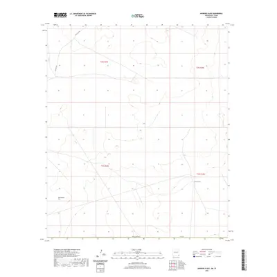
2020 Map of Andrews Place
USGS Topo · Published 2020About this map
Andrews Place serves as the primary landmark in this sparsely settled corner of Lea County, New Mexico, positioned near the transition between Township 25 South and 26 South. The landscape is defined by broad topographic features such as Rattlesnake Flat, where subtle elevation changes suggest the open, arid character of the Permian Basin region. Infrastructure is limited to a handful of thoroughfares, most notably Battle Axe Rd and Co Rd 2, which provide essential transit across the high plains. The map meticulously documents the Public Land Survey System grid, including t25s r34e and t25s r35e, reflecting the structured parceling of this western rangeland as it appeared in the late 2010s.
Find a feature on this map
10 named features on this map. Tap any name to fly to it.
Don’t see what you’re looking for? This feature index may not catch every label — zoom into the map to look around manually.
Map Details
Editions of this 2020 Andrews Place Map
This is the sole edition of this map. No revisions or reprints were ever made.
Other maps of this area

1954 · Hobbs
USGS Topo · 1:250,000

1954 · Pecos
USGS Topo · 1:250,000

1957 · Pecos
USGS Topo · 1:250,000

1958 · Hobbs
USGS Topo · 1:250,000

1969 · Rudd Draw NE
USGS Topo · 1:24,000

1970 · Brunson Ranch
USGS Topo · 1:24,000

1970 · Cheyenne Draw
USGS Topo · 1:24,000

1973 · Javelina Basin
USGS Topo · 1:24,000

1973 · Bell Lake
USGS Topo · 1:24,000

1973 · Paduca Breaks East
USGS Topo · 1:24,000