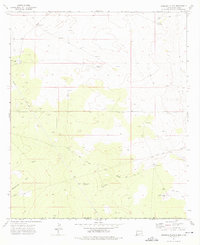
1973 Map of Andrews Place
USGS Topo · Published 1976About this map
Diamond and a Half Ranch and Andrews Place anchor this 1970s landscape along the border of New Mexico and Texas. The terrain is defined by the expanse of Rattlesnake Flat, where the economy of the era is clearly visible through a network of pipelines and numerous drill holes scattered across the high plains. Water management for ranching and industrial use is a primary feature of the topography, evidenced by landmarks like the Andrews West Windmill, Hardin Tank, and Andrews South Tank. This survey reflects a mid-century period of resource extraction and cattle ranching in Lea and Loving counties, where unpaved jeep trails provide the primary access to remote gravel pits and survey points along the state line.
Find a feature on this map
13 named features on this map. Tap any name to fly to it.
Don’t see what you’re looking for? This feature index may not catch every label — zoom into the map to look around manually.
Map Details
Editions of this 1973 Andrews Place Map
This is the sole edition of this map. No revisions or reprints were ever made.
Other maps of this area

1954 · Hobbs
USGS Topo · 1:250,000

1954 · Pecos
USGS Topo · 1:250,000

1957 · Pecos
USGS Topo · 1:250,000

1958 · Hobbs
USGS Topo · 1:250,000

1969 · Rudd Draw NE
USGS Topo · 1:24,000

1970 · Brunson Ranch
USGS Topo · 1:24,000

1970 · Cheyenne Draw
USGS Topo · 1:24,000

1973 · Javelina Basin
USGS Topo · 1:24,000

1973 · Bell Lake
USGS Topo · 1:24,000

1973 · Paduca Breaks East
USGS Topo · 1:24,000