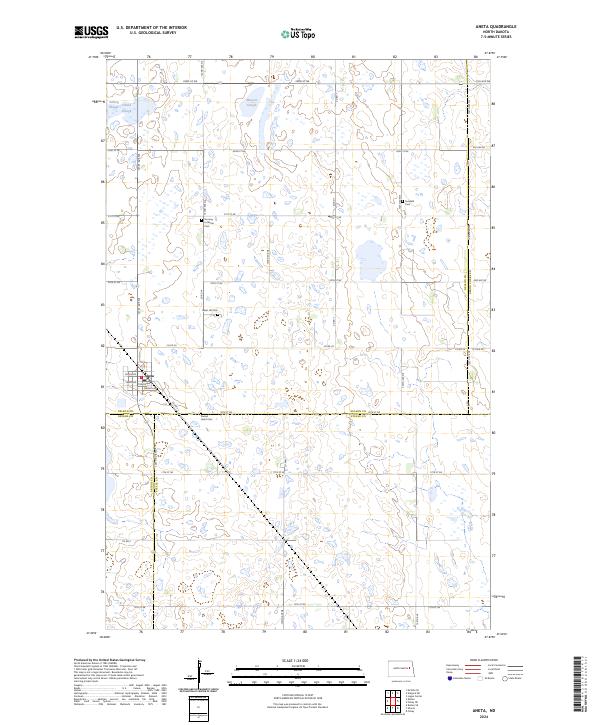
2024 Map of Aneta
USGS Topo · Published 2024About this map
Aneta sits at the nexus of several North Dakota counties, anchoring a prairie landscape defined by its glacial heritage and agricultural grid. This survey highlights the complex drainage of the region, where numerous wetlands and sloughs such as Matson Slough, Solberg Slough, and Omild Slough punctuate the farmland. Large protected tracts like the Nelson County Waterfowl Production Area reflect a commitment to preserving these vital habitats within the working landscape. Local history and genealogy are anchored by several rural cemeteries, including Norway Lutheran Cem, Sundahl Cem, and Silent Hill Cem, which are scattered throughout the sections of t149n r57w. The town itself is clearly mapped with its residential streets, including Main Ave and Thayer Ave, providing a detailed look at this Nelson County community and its surrounding township lines.
Find a feature on this map
37 named features on this map. Tap any name to fly to it.
Don’t see what you’re looking for? This feature index may not catch every label — zoom into the map to look around manually.
Map Details
Editions of this 2024 Aneta Map
This is the sole edition of this map. No revisions or reprints were ever made.
Other maps of this area

1939 · Niagara
USGS Topo · 1:62,500

1942 · McVille
USGS Topo · 1:62,500

1952 · Grand Forks
USGS Topo · 1:250,000

1952 · New Rockford
USGS Topo · 1:250,000

1956 · New Rockford
USGS Topo · 1:250,000

1956 · Grand Forks
USGS Topo · 1:250,000

1963 · Niagara SW
USGS Topo · 1:24,000
1963 · McVille SE
USGS Topo · 1:24,000

1963 · Logan Center
USGS Topo · 1:24,000

1966 · Grand Forks
USGS Topo · 1:250,000