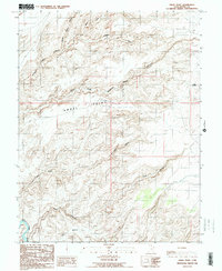
1986 Map of Angel Point
USGS Topo · Published 1987About this map
Angel Point and the complex drainage systems of the San Rafael Desert dominate this 1980s landscape in Wayne County. The map captures a transition between high mesas and deeply incised desert washes, most notably the three branches of North Fork, Middle Fork, and South Fork Robbers Roost Canyon. These labyrinthine corridors feed into the larger plateau system, where the isolated Landing Strip provides a solitary mark of modern infrastructure amidst the natural terrain.
Find a feature on this map
10 named features on this map. Tap any name to fly to it.
Don’t see what you’re looking for? This feature index may not catch every label — zoom into the map to look around manually.
Map Details
Editions of this 1986 Angel Point Map
2 editions found
Other maps of this area

1885 · San Rafael
USGS Topo · 1:250,000

1952 · Bull Mountain
USGS Topo · 1:62,500

1953 · Orange Cliffs 3 NE
USGS Topo · 1:24,000

1953 · Orange Cliffs 3 NW
USGS Topo · 1:24,000

1953 · Fiddler Butte
USGS Topo · 1:62,500

1956 · Salina
USGS Topo · 1:250,000

1960 · Salina
USGS Topo · 1:250,000

1962 · Salina
USGS Topo · 1:250,000

1963 · Robbers Roost Canyon
USGS Topo · 1:62,500
1963 · Hanksville
USGS Topo · 1:62,500