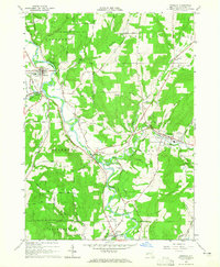
1964 Map of Angelica
USGS Topo · Published 1965About this map
The Genesee River cuts a wide, meandering valley through this portion of Allegany County, shaping the development of settlements like Belfast and Angelica. In the mid-1960s, the landscape reflects a transition from early industrial transport to modern infrastructure, evidenced by the trace of the Genesee Valley Canal and the active Erie Lackawanna Railroad corridor. The village of Angelica serves as a focal point, featuring the County Fairgrounds, an Athletic Field, and the Central Sch.
Find a feature on this map
68 named features on this map. Tap any name to fly to it.
Don’t see what you’re looking for? This feature index may not catch every label — zoom into the map to look around manually.
Map Details
Editions of this 1964 Angelica Map
3 editions found
Other maps of this area

1906 · Angelica
USGS Topo · 1:62,500

1916 · Canaseraga
USGS Topo · 1:62,500

1925 · Belmont
USGS Topo · 1:62,500

1926 · Wellsville
USGS Topo · 1:62,500

1939 · Belmont
USGS Topo · 1:62,500

1940 · Canaseraga
USGS Topo · 1:62,500

1941 · Angelica
USGS Topo · 1:62,500

1950 · Elmira
USGS Topo · 1:250,000

1958 · Elmira
USGS Topo · 1:250,000

1960 · Buffalo
USGS Topo · 1:250,000