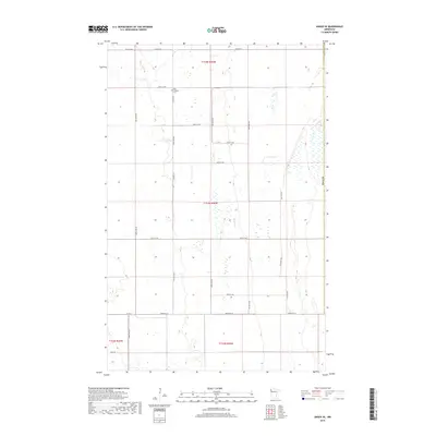
2019 Map of Angus SE
USGS Topo · Published 2019About this map
Melo Lutheran Cem serves as a primary historical landmark in this agricultural section of Polk County, situated near the intersection of Co Hwy 23 and 160th St NW. The landscape is defined by the rigid geometry of the Public Land Survey System, with township lines for t154n r46w, t153n r46w, and t152n r46w organizing the vast network of section roads. Drainage patterns and seasonal wetlands break the prairie flatness, particularly along the eastern edge of the quadrangle. Significant local thoroughfares like Co Hwy 69 and Center St W provide the backbone for transport between the scattered farmsteads of the Red River Valley. The presence of Field Rd in the southwest corner highlights the purely utilitarian nature of the rural infrastructure at this time.
Find a feature on this map
27 named features on this map. Tap any name to fly to it.
Don’t see what you’re looking for? This feature index may not catch every label — zoom into the map to look around manually.
Map Details
Editions of this 2019 Angus SE Map
This is the sole edition of this map. No revisions or reprints were ever made.
Other maps of this area

1918 · Angus
USGS Topo · 1:62,500

1918 · Red Lake Falls
USGS Topo · 1:62,500

1918 · Viking
USGS Topo · 1:62,500

1952 · Red Lake Falls
USGS Topo · 1:62,500

1952 · Grand Forks
USGS Topo · 1:250,000

1952 · Thief River Falls
USGS Topo · 1:250,000

1953 · Crookston
USGS Topo · 1:62,500

1956 · Thief River Falls
USGS Topo · 1:250,000

1956 · Grand Forks
USGS Topo · 1:250,000

1957 · Thief River Falls
USGS Topo · 1:250,000