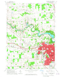
1965 Map of Ann Arbor West
USGS Topo · Published 1967About this map
The Huron River winds through the mid-1960s landscape of Washtenaw County, anchoring a series of riverside communities and recreation areas. The western expansion of Ann Arbor is clearly visible, with residential developments reaching toward Veterans Park and numerous schools like Forsythe Jr High Sch and Eberwhite Sch serving the growing population. To the northwest, the map captures the distinct character of Barton Hills near the Barton Pond reservoir and the small settlement of Delhi Mills.
Find a feature on this map
67 named features on this map. Tap any name to fly to it.
Don’t see what you’re looking for? This feature index may not catch every label — zoom into the map to look around manually.
Map Details
Editions of this 1965 Ann Arbor West Map
Other maps of this area

1902 · South Lyon
USGS Topo · 1:62,500

1902 · Ypsilanti
USGS Topo · 1:62,500

1902 · Dexter
USGS Topo · 1:62,500

1904 · Ann Arbor
USGS Topo · 1:125,000

1906 · Ypsilanti
USGS Topo · 1:62,500

1906 · Dexter
USGS Topo · 1:62,500

1906 · Saline
USGS Topo · 1:62,500

1906 · South Lyon
USGS Topo · 1:62,500

1908 · Ann Arbor
USGS Topo · 1:125,000

1954 · Detroit
USGS Topo · 1:250,000
Featured Places
- Ann Arbor, MI
- Pittsfield Charter Township, MI
- Scio Township, MI
- Northfield Township, MI
- Webster Township, MI