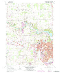
1965 Map of Ann Arbor West
USGS Topo · Published 1984About this map
The Huron River corridor defines the landscape of this 1965 survey, updated in the early 1980s to show the expanding urban footprint of Ann Arbor. The river’s course is punctuated by significant local recreation and infrastructure, including Dexter-Huron Metropolitan Park and the prominent Barton Pond. Small, historic clusters like Delhi Mills and Foster sit along the water, while the northwest corner retains its rural character through family-named landmarks like Williams Cem and Webster Ch. The suburban growth of the era is evident in the dense network of schools, such as Eberwhite Sch and Slauson Jr High Sch, and specialized sites like Mercywood Hospital and the Drive-in Theater. This edition is particularly useful for tracking the conversion of former gravel operations and agricultural land into the modern residential and institutional fabric of Ann Arbor Twp.
Find a feature on this map
94 named features on this map. Tap any name to fly to it.
Don’t see what you’re looking for? This feature index may not catch every label — zoom into the map to look around manually.
Map Details
Editions of this 1965 Ann Arbor West Map
Other maps of this area

1902 · South Lyon
USGS Topo · 1:62,500

1902 · Ypsilanti
USGS Topo · 1:62,500

1902 · Dexter
USGS Topo · 1:62,500

1904 · Ann Arbor
USGS Topo · 1:125,000

1906 · Ypsilanti
USGS Topo · 1:62,500

1906 · Dexter
USGS Topo · 1:62,500

1906 · Saline
USGS Topo · 1:62,500

1906 · South Lyon
USGS Topo · 1:62,500

1908 · Ann Arbor
USGS Topo · 1:125,000

1954 · Detroit
USGS Topo · 1:250,000
Featured Places
- Ann Arbor, MI
- Pittsfield Charter Township, MI
- Scio Township, MI
- Northfield Township, MI
- Webster Township, MI