
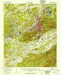
1950 Map of Anniston
USGS Topo · Published 1953About this map
Anniston serves as the industrial and military anchor of this North Alabama landscape, flanked by the sprawling Fort McClellan Military Reservation to the north and the massive Anniston Ordnance Depot to the west. The mid-century urban core shows a dense street grid radiating from the Southern and Louisville & Nashville railroad corridors, while nearby Hobson City and Oxford represent established community hubs. To the south, the terrain shifts into the protected woodland of the Talladega National Forest, where landmarks like Pine Mountain and Horseblock Mountain rise above the drainage of Choccolocco Creek.
Find a feature on this map
97 named features on this map. Tap any name to fly to it.
Don’t see what you’re looking for? This feature index may not catch every label — zoom into the map to look around manually.
Map Details
Editions of this 1950 Anniston Map
2 editions found
Other maps of this area

1889 · Springville
USGS Topo · 1:125,000

1890 · Talladega
USGS Topo · 1:125,000

1891 · Ashland
USGS Topo · 1:125,000

1892 · Springville
USGS Topo · 1:125,000

1892 · Talladega
USGS Topo · 1:125,000

1900 · Anniston
USGS Topo · 1:125,000

1943 · Talladega
USGS Topo · 1:62,500

1946 · Talladega
USGS Topo · 1:62,500

1947 · Oxford
USGS Topo · 1:24,000

1947 · Anniston
USGS Topo · 1:24,000